ROSELAND LAKE NUTRIENT LOADS
MODELING PROJECT
By Jean Pillo, Eastern Connecticut Conservation District, August, 2015
Roseland Lake is a 96 acre natural lake located in Woodstock, CT. After the last ice age, a large sand and gravel deposit formed under what is referred to as glacial “Lake Quinebaug”. What was left behind is where the Quinebaug River now flows. An arm of Lake Quinebaug followed what is now the Little River into Woodstock. During ice melt, deeper pockets formed here and there. Roseland Lake is where one of those deeper pockets formed. The maximum depth of the lake is 18 feet, and the average depth is about 9 feet.
 Roseland Lake was a summer retreat destination for many during the 1800s. Henry Bowen, of the Woodstock “pink house” fame, financed the improvement of the western shore of the lake and made what is now known as Roseland Park. Much of the land in the park was too swampy, so he hired local laborers to haul wagon loads of soil to add fill where needed. While this would be a violation of modern inland wetland regulations, the park is an accepted feature of the modern landscape. Many living local residents recount taking swimming lessons in Roseland Lake and reminisce about diving off the dock into the water.
Downstream of Roseland Lake, the Town of Putnam withdraws water from Little River to use as a source of drinking water. Water upstream of a surface water supply is protected by various regulations. For example, it is not permitted to discharge industrial or treated sewage into a river upstream of a drinking water intake in Connecticut. It is also not permitted to allow a public bathing beach less than 2 miles upstream of the intake. The latter rule led to the closing of the Roseland Park public swimming beach. However, despite these efforts to protect the water quality in Roseland Lake, the water quality in the lake has been degrading for decades. Excess nutrients and sediment runoff from diffuse sources have caused the lake to be categorized as hypereutrophic. The excess nutrients in the lake cause severe seasonal algal blooms and decreased dissolved oxygen concentrations below the lake surface. Of particular concern are potential Harmful Algae Blooms of blue green algae, some of which may produce a toxic by-product. The excess algae makes it more expensive to filter and treat the drinking water drawn from Little River, and may give the water a bad taste and smell. The lack of oxygen below the lake surface degrades the habitat for fish and other aquatic organisms.
The Eastern Connecticut Conservation District (ECCD) has collaborated with CT DEEP, USDA Natural Resources Conservation Service (NRCS) and others to decrease nutrient and sediment laden runoff into Roseland Lake. In 2009, ECCD completed a review of the watershed above Roseland Lake and prepared the Little River, Muddy Brook and Roseland Lake Abbreviated Watershed Based Plan. This Plan contains recommendations for changes that will lead to improved water quality in rivers, streams and lakes within the watershed. One of the recommendations in the Plan is to investigate if the nutrients stored in the sediments at the bottom of the lake are contributing to the lake’s water quality issues. Lake chemistry is complex, but during summer months, it is possible that nutrients, specifically phosphorus, get released from the bottom sediments when there is no oxygen in the water. If that phosphorus gets mixed in with the water at the surface where there is light to support photosynthesis, it helps to support the growth of algae. There are lake management strategies to use to reduce algae blooms that may be different from how the lake is managed now, but critical water quality information is unknown. It is also important to know how much polluted land runoff is still reaching the lake before the best lake management strategy can be decided.
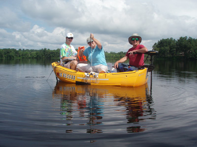
In 2015 ECCD, with funding from an EPA Clean Water Act § 319 grant through the CT DEEP, began collecting water samples from Roseland Lake and the tributaries above it to get data on which to make lake management decisions. The data will also help decide which areas upstream of Roseland Lake are higher priorities to reduce polluted runoff. The last comprehensive study of the Roseland Lake tributaries, including Muddy and Mill Brook, was completed in 1991 by the USGS using data collected in the early 1980s. There have been snapshot studies of water quality in the lake itself, but as part of this project, ECCD will be completing a more comprehensive study of the lake from spring to fall. ECCD will have many partners on this project, including the Connecticut Department of Public Health Drinking Water Division and representatives from the Putnam Water Pollution Control Authority and the Town of Woodstock. ECCD will contract with the USGS Water Science Center to collect and analyze sediment samples for phosphorus concentrations. Volunteers trained as part of The Last Green Valley Water Quality Monitoring Program will assist with water sampling. Dr. Richard Canavan of CME Associates, Inc., is a lake specialist by training. He has been hired to assist with data interpretation.
The end products of this project will include a mathematical model of how nutrients cycle in Roseland Lake; recommendations for lake management strategies; measurements of nutrient loads coming into the lake from upstream sources and the development of priority areas for funding assistance to reduce those loads. ECCD hopes to improve the water quality in this lake for people and wildlife. Project updates will be posted to our ECCD Facebook page, and on a Roseland Lake website www.roselandlake.org managed by a local volunteer. There are volunteer opportunities available to assist us with this project. Contact Jean Pillo at 860-928-4948 extension 605 for more information.